Winter is upon us. This doesn’t mean we have to strike a baleful note of doom, though it should remind many of us that winter generally brings more cloudy skies to North America. In 2015, an Alaska-based climate blogger, Brian Brettschneider, examined cloud coverage data from selected weather stations in the National Climate Data Center’s (NCDC) Global Historical Climatology Network (GHCN). He created a series of maps showing the cloudiest parts of the U.S., the distribution of cloud cover by month and the cloudiest months for each first order reporting station.
Kurt Rogghé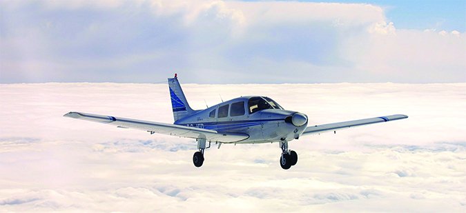
Not surprisingly, the cloudiest months for warm and temperate continental areas cluster in the winter and spring months. From what we know about the primary cause of seasonal weather (the effect of axial tilt on solar energy per unit area of earth’s surface), this should come as no surprise. The notable exceptions to this winter-cloud trend are the desert southwest, eastern seaboard, Hawaii and Alaska. All are a bit out of step with more typical patterns seen in the majority of the U.S., with Alaska as the sidebar at the top of the opposite page highlights.
What Happens
During warmer seasons, the overhead sun heats the ground and overlying air. Unstable, warm-season air currents rise to form billowing cumuliform clouds that do one of two things: either they rise, form and dissipate; or, with sufficient moisture, energy and instability, they rise, consolidate and grow into convective thunderstorms. The thing about thunderstorms is their transient birth, life and death cycle rarely takes over and becomes a dominant weather pattern for weeks or months at a time.
In contrast, during colder seasons, the winter and early spring months, the opposite process dominates. The rays from our low-angled sun deliver far less heat to the surface. The cooler atmosphere often stratifies horizontally into stable inversion layers with colder air often trapped at the ground level under warmer air. Inversion layers are usually widespread and long-lasting, so overcast layers effectively settle in. As a result, winter overcast layers tend to be horizontally stratified and often contained to fairly low layers.
If you’re a pilot and tired of winter’s often overcast and dreary days, there is hope. If you can safely get through the layers of winter overcast without picking up ice, you will often find bright sunny conditions above the winter layers. Here in the Pacific Northwest, where I do most of my flying, the overcast settles in for the winter and can last for months at a time. But I have found that when I can climb through the depressing environment into a blindingly bright sunny day, it is almost a religious experience that lifts my spirits for days.
Moisture’s Seasonal Impact
An additional characteristic of the atmosphere is moisture, or more specifically the amount of water vapor a parcel of air is capable of holding. This moisture has many impacts throughout the spectrum of meteorological phenomena, not least of which is precipitation. Indeed, the air’s moisture content impacts how clouds and precipitation form, and it serves as a means for transferring heat energy.
Any parcel of air kept at a constant pressure will hold an amount of water vapor in direct proportion to its temperature. Warmer air can hold more water vapor; cooler air, less. Though it may be measured in a number of different ways, pilots tend to think of the amount of water vapor present in a given air sample using concepts like relative humidity and dewpoint. The FAA’s Advisory Circular AC 00-06B, Aviation Weather, advises that, “Dewpoint is the temperature [to which] an air parcel must be cooled at constant pressure and constant water vapor pressure to allow the water vapor in the parcel to condense into water (dew).
“The temperature greatly affects the air parcel’s ability to hold water vapor, while the dewpoint indicates the actual quantity of water vapor in the parcel. As the spread decreases, relative humidity increases. When the spread decreases to zero, relative humidity is 100 percent, and the air parcel is saturated.
“Surface temperature-dewpoint spread is important in anticipating fog, but has little bearing on precipitation. To support precipitation, air must be saturated through thick layers aloft,” the AC adds.

We see the atmosphere’s moisture content impact weather differently in the extremes of summer and winter. In summer, that moisture tends to help form showery precipitation as the sun’s heat warms the air and causes it to rise. At the same time, the air’s ability to hold water vapor increases, a cycle that often continues to loop back on itself, especially if moisture and heat are in great supply. The classic result, of course, is a thunderstorm, which causes precipitation to fall when the warm, rising air meets colder air aloft and the water vapor condenses into rain or even hail.
In the winter, the sun’s heat energy is reduced, and so must the atmosphere’s ability to hold water vapor. But that doesn’t mean clouds don’t form and precipitation doesn’t occur. They just occur differently. That’s because a cloud is visible water (droplets and/or ice particles) in the atmosphere. Fog also is a cloud, but with its base at the earth’s surface instead of above it. Clouds form the same way at all altitudes: when temperature and dewpoint meet, whether by condensation of water vapor in the air rising to cooler altitudes or by evaporation, in the case of a cloud close to the ground (e.g., fog). Some lifting action is necessary for precipitation of moderate and heavy intensity, which doesn’t happen as frequently in winter months solely as a result of the sun’s heating.
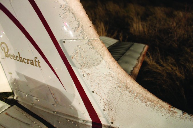

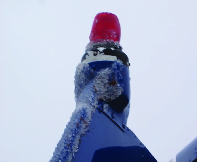
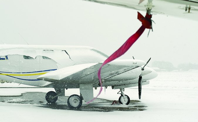
Moisture’s final impact on our weather also is related to the season: Some types of precipitation only form in the winter. Or, as Aviation Weather puts it, “The vertical distribution of temperature will often determine the type of precipitation that occurs at the surface. Snow occurs when the temperature remains below freezing throughout the entire depth of the atmosphere. Ice pellets (sleet) occur when…snow falls into [a] shallow warm layer [and] the snowflakes partially melt” then refreeze into ice pellets. Freezing rain occurs when liquid water from a warm layer aloft with above-freezing temperatures falls into a below-freezing layer at the surface. Rain occurs when there is a deep layer of above-freezing air based at the surface
Winter Inversions
From a risk management perspective, pilots need to understand that the seasonal and regional patterns that dominate one region will probably not hold as you move across the continent or travel to or through different regions. Similarly, each region can have its own dominant seasonal patterns. The very capabilities our airplanes provide, to overcome mountain ranges and transit portions of the continent in hours rather than days, can set us up for surprises.
I often travel to the Columbia Basin where winter months often produce strong stagnant inversions that settle in on clear nights. This regional dynamic results when the cold air that accumulates over the basin floor on clear nights is held in place by a strong capping inversion of increased temperatures aloft. The warm air cap that produces this inverse effect is primarily produced by downslope warming from the strong westerly winds that descend the lee slopes of the Cascades on the western boundary of the basin.
The first time I encountered the phenomena, I could see from the TAF that fog would be developing at exactly my planned time of my arrival, about 7 p.m. I thought it would simply be a localized event near the Columbia River and pass in a few days, as it almost always does where I am based, on the Snake River on the Snake River Plain. It didn’t work out that way.
The city lights were in sight as I descended to my planned airport, and I was happy I had timed my approach perfectly. But as I got closer, I was dismayed to see, and then not see, the runway lights. They disappeared beneath a ground level fog that appeared in the amount of time it took me to tune in and listen to the local weather advisory, sadly still reporting clear skies.
The strobe light of the ILS rabbit serving the next-nearest alternate airport were still visible and in the clear, so I called the tower for a clearance. Unfortunately, an airliner had just landed on the clear end of the runway that I could actually see from a distance…and then came to a stop in the fog that had engulfed the other half of the runway and was now stranded. The visibility on that end of the runway was less than 100 feet, and the airliner crew had difficulty trying to find the taxiway to exit. By the time I did one circle, the rest of the runway was engulfed, and with visibility in the hundreds of feet, the airport was effectively closed.
Fortunately, I made it to the next (third!) nearest airport where the conditions had not yet hit. Over the next few days, I learned more about Columbia Basin inversions, which are not short-term or transient, unlike the winter fog inversions at my home airport. My plane was stranded for more than a week. The lesson was clear to me: Don’t try to apply weather knowledge learned from patterns at your home aerodrome to places hundreds of nautical miles away, surrounded by different mountain ranges and located in a completely different part of the continent.
Mike Hart is an Idaho-based, instrument-rated commercial pilot, and proud owner of a 1946 Piper J-3 Cub and a Cessna 180. He also is the Idaho liaison to the Recreational Aviation Foundation.


