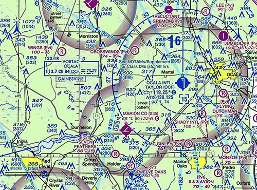
At right is a sectional chart excerpt, covering the Ocala (Florida) International Airport-Jim Taylor Field, KOCF. You want to get to nearby Marion County Airport (X35), shown here at the end of the blue line to the southwest. Also depicted are two areas of obstructions on either side of your route, circled in red, just to make it interesting. Thanks to the Class E airspace at Marion County, the only legal way to conduct the proposed flight is to remain at or below 699 feet agl upon leaving Ocala’s Class D.
© 2024 Firecrown. All rights reserved.


