
The private pilot/owner planned to fly to at least two back country airports in a neighboring state. His first destination was an unpaved USFS strip. The runway, oriented 11/29, was reported to be 2765 feet long and 50 feet wide. It was located in a narrow valley, and situated about 30 feet southwest of the main road that transited the valley. An unpaved road exited the main road immediately southeast of the threshold of Runway 29, and then turned northwest to initially merge with the runway. About 300 feet northwest of the threshold, the unpaved road diverged slightly southwest of the runway, before assuming a track separate from but parallel to the runway.
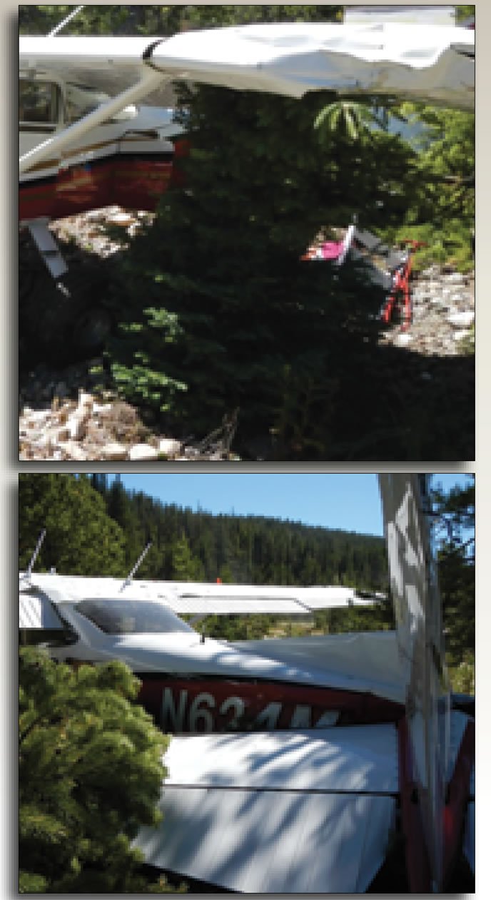
The pilot landed uneventfully on Runway 11, and since the wind was calm, planned to depart from Runway 29. He taxied to the end, turned around, and idled for a few minutes while reviewing the next flight leg. He then began his takeoff roll on what he believed to be Runway 29. At some point the left main tire struck a hole. The airplane veered to the left, its left wingtip struck trees, and the pilot lost directional control. The airplane veered further left, struck more trees and came to rest pointed about 90 degrees from the runway heading. The wings and fuselage sustained substantial damage, but the pilot was uninjured.
Subsequently, the pilot recognized he had inadvertently tracked the unpaved road instead of the runway for the takeoff attempt. Review of photographs of the runway environment indicated that the conjoined runway and road was conducive to such confusion. Commercial and FAA documents noted the road crossed the runway about 800 feet from the threshold of Runway 11, but there were no references to the conjoining of the road and runway at the threshold of Runway 29 or the potential for confusing the two. Subsequently, the Idaho Transportation Department added a cautionary note regarding the road to its Airport Facility Directory.


