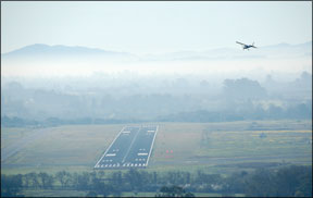
November 12345, youre cleared from the Backwoods Airport to the Backwoods NDB, then hold as published. Climb and maintain 3000 feet, squawk 2012. Report airborne on frequency 125.1. Clearance void if not off by two-zero past the hour; time now zero-five past the hour. Expect further clearance at two-five past the hour.” 288 Fly IFR from non-towered, out-of-the-way airport, and youll eventually get a short-range clearance like the one above. Its a clearance to a nearby fix with a time window (until the “void time”) allowing you to enter controlled airspace without conflicting with other IFR airplanes. Since ATC cant see you on radar yet and wont know exactly when youll enter controlled airspace from that non-towered field, theyll keep a small area clear for you until the void time. Once youre airborne and check in with ATC, youll likely be given an immediate clearance to your destination-if they have you on radar. I used to get that kind of short-range clearance all the time when flying out of a non-towered airport in the radar-blocking hills of east Tennessee. NODAR Climbing out of a non-towered airport below radar coverage (whether on a short-range clearance or with clearance all the way to destination), its your responsibility to arrive safely at the first IFR altitude and fix. If the airport has a published instrument departure procedure, follow it. Chances are, though, that theres no published method of getting from the runway to a safe en route altitude. Heres where you have to do some homework. Its your job-you have the authority and the responsibility-to choose a departure route keeping you clear of obstacles. This job gets easier if you: Ask the locals for suggestions for flying an instrument departure. Is there a corporate pilot or an instrument instructor hanging around the FBO? Pick a few brains. And dont pass up the advice of VFR-only local pilots who know the local terrain better than you. If weather conditions are VFR and you can remain in visual conditions all the way to the first fix-perhaps with some maneuvering as required for terrain, obstacle and traffic avoidance-do that. In good VMC, you may simply depart VFR and pick up your clearance in the air. Just be sure you can remain in VMC in case communications, traffic or other ATC problems prevent you from getting your clearance right away. For reasons why, see the sidebar on page 22, “The Hills of Rome.” If you cant stay in VMC all the way to the first fix, but the airport has a published instrument approach for the runway youre using, there also will be a missed approach procedure for that runway. Since the miss is a prescribed route and altitude to fly away from the airport from the missed approach point guaranteeing obstacle clearance, using it is a good bet. Take off and immediately fly the published missed approach procedure. Often a short-range clearance takes you to the missed-approach holding fix anyway. When using a miss as your impromptu DP, remember: The missed approach procedure presumes you begin climbing from a point several hundred feet above the runway, and often from a position before or immediate over the approach-end runway threshold. Taking off, youre starting from an altitude (field elevation) well below the decision height (DH)/decision altitude (DA) or the minimum descent altitude (MDA) for the approach youre “missing.” Youre responsible for terrain and obstacle clearance until you get to at least the DH/DA/MDA altitude and then intercept the climb profile of the missed approach procedure. Since youre not starting from prior to the threshold, where DH/DA is located, use the MDA as your initial target height. Youll need to get there quickly-fly a best-angle climb until you reach MDA-so youll be at a safe altitude before you fly past the end of the departure runway. If your departure airport doesnt have a published approach for the runway youre using, but does have an approach for another runway, look at the published approach for the other runway, take off and intercept the circling approach missed approach procedure. Again, youre solely responsible for getting from the ground to that first safe altitude, the circling minimum. If the airport has no published approaches at all, or has only approaches using navaids you cant receive with your installed equipment, you have the authority (and responsibility) to devise your own way of getting to minimum vectoring altitude (MVA). Look at the local sectional chart and Airport/Facilities Directory for any information about obstacles and terrain. Adhere to visual airport traffic patterns and other peculiarities of the runway youre departing. Check Notams for all those unlighted tower warnings that crop up as cell-phone towers slowly take over the world. Consider simply climbing in the airport traffic pattern (which should be clear of obstructions) until you reach a safe altitude and can proceed on course. In short, precisely plan your departure before engine start, then fly your plan until youre in the comfortable arms of ATC. Non-Radar En Route Once upon a time, I was flying toward Santa Fe, N.M. Over darkest west Kansas, cruising at the 10,000-foot minimum en route altitude (MEA), ATC called, “Radar service terminated. Radio contact will be lost in the next few miles. Attempt contact on [frequency] every 10 miles until you make contact with Albuquerque Center.” It was a little unnerving to be in IMC at the MEA with neither radar nor radio contact, but I pressed on, got Albuquerque Center on the radio about 10 minutes later, and eventually was picked up again on radar. When youre below radar coverage (or the radar system is down, or your transponder goes inop and ATC cant paint you as a primary target), at least one of the following on-airway minimum altitudes apply. The MEA is designed to keep you above obstacles and terrain on airways, and assure reception of ground-based navaids defining the airway. It works whether youre in radar contact or not. The minimum obstacle clearance altitude (MOCA) provides the obstacle clearance of the MEA, but not necessarily the ground-based navaid reception more than 25 miles from the beacon. The good news? If youre navigating an airway with an en route-certified GPS you can file and fly the MOCA even in a non-radar environment, if for some reason you want to fly lower than the MEA (to stay below ice, for instance). If you lose the GPS signal youll have to climb back to the MEA. The minimum reception altitude (MRA) assures reception of off-airways navaids used to define intersections. Like the MOCA, if youre using a certified GPS for navigation, this does not apply…radar or no. When off airways, ATC will issue clearances and permit direct routings only if the airplane is in radar contact and the airplane is at or above the minimum vectoring altitude (MVA), the lowest altitude where controllers have reliable radar coverage. It varies geographically and does not appear on any charts available to the IFR pilot. If you file for an off-airways route youll need to review the sector altitudes on sectional or en route charts for the minimum altitude for each sector through which youll fly. Those values may not be the MVA, but theyll be close. If youre not in radar contact you must fly on airways and published transitions in the IFR system. What goes up… …must come down, and quite often descends below radar coverage before completing an approach. When ATC says “radar service terminated,” your responsibility tangibly changes. Youre on your own-“own nav”-for any transitions and instrument approaches. Follow the procedure, without shortcuts. If your destination has no instrument approach, you need to be able to descend from the en route altitude to the runway while remaining visual-true VMC, three miles visibility, 500 feet below clouds, 1000 feet above them and 2000 feet laterally until you are in Class G airspace very close to the ground. Just because youre told youre no longer under radar coverage, dont be tempted to immediately cancel IFR. If youre just skimming the bottom of the clouds in most Class E airspace, even if you see the runway, VFR isnt legal, so you need to stay on your IFR clearance. If youre in Class B airspace, you need to work out a VFR clearance in that airspace before you cancel IFR, even if youre already talking to the Class B controller. And pilots have been violated for canceling IFR with approach while inside the confines of Class D airspace but before they were handed off to the tower-suddenly the pilot is in Class D airspace without permission to be there. Radar or not, know where you are, and where youre going, before canceling your instrument clearance in the air. Missing the approach in a non-radar environment? Fly the published procedure, and contact the appropriate controller as soon as workload permits. When youre cleared for the approach, you are also cleared to fly the missed approach procedure. If youre not being tracked by radar, youll have a larger bubble of protected airspace around you controllers will not let others penetrate. This is why youll be put in a hold when conditions are so low the pilot before you could not cancel before landing-controllers must presume the other guy is still using the airspace until they learn otherwise. Radar service is convenient, its comforting and it adds a significant layer of safety to IFR operations. There are times, however, when we dont have extra eyes tracking our every move. In those instances, its up to us to plan and execute a route and altitude to keep ourselves safe. Its not hard, but we do need to remember the rules, use a slightly different set of tools and-especially-accept responsibility for things like obstacle clearance we usually take for granted. Tom Turner is a CFII-MEI who frequently writes and lectures on aviation safety.


