
by Paul Bertorelli
For anyone equipped with it-and these days, thats most of us-GPS is a terrific addition to the cockpit. Its accurate, reliable and is proving to be an indispensable approach aid. But theres a dark side to the GPS revolution: the FAA has done a poor job of training controllers to understand how airplanes should fly GPS procedures. Although its not universally true, many controllers are clueless in issuing GPS approach clearances and missed approach instructions; their lack of knowledge shows up in the system every day.
The risk of an accident is probably low, but the ingredients are in place for the kind of high-profile wreck that fundamentally reshapes instrument and ATC procedures. The FAA seems only vaguely aware of what is an obvious shortcoming in training, but it has larger fish to fry so we dont see much improvement for the short term.
Until then, as an instrument pilot, you can protect yourself against sloppy ATC handling by understanding the technical issues at hand and listening up for the exact words the controller uses to clear you for an approach. Terrain awareness-again, via a GPS moving map-is a must-have survival skill in the brave new world of GPS approaches.
The Magic Words
Youve heard the standard IFR approach clearance dozens of times: Four miles from LIMA. Turn right heading 340. Maintain 2000 until established on the localizer. Cleared ILS Runway 36 approach. The exact words in such a clearance owe their existence to the crash of TWA 514 on December 1, 1974. The crew of that 727 was flying a VOR-DME approach into Washingtons Dulles International Airport on a stormy, turbulent day, having been diverted from their original destination, Washington National. While setting up for the approach, the crew became confused about when to descend on the initial leg of the procedure into Dulles. They descended too soon and struck high terrain, killing everyone aboard.
The NSTBs response to this accident was to recommend to the FAA that controllers add position information and altitude restrictions to approach clearances when aircraft were vectored onto approach courses. Even with non-radar procedures, where the pilot is supposed to navigate himself onto the approach course, controllers routinely issue crossing restrictions that remind the pilot not to begin his descent until hes safely established on the black lines of the procedure and upon crossing a specified fix.
Being unwedded to any fixes defined by ground-based navaids, GPS approaches can point at any runway from any direction, terrain permitting. This flexibility has tended to detach GPS approaches from the traditional airway structure and given birth to something called the terminal arrival area or TAA.
The TAA concept is that approaches can be entered through a wide area-usually at least 180 degrees-thats free of obstacles above specified altitudes and a specified distance from the fix named on the chart. Usually, the 180-degree segment is defined by radials from an initial approach fix on one of the legs of the familiar T-structure that most new GPS approaches have.
Many-but far from all-new approaches have a TAA, a design that offers obvious efficiencies. An airplane can enter the approach at any of the IAFs and fly straight in, with no need for a procedure turn to scrub off altitude and get aligned for the final approach course. Furthermore, GPS navigators certified under TSO C129 are designed to minimize pilot workload by autosequening through the fixes on the T-legs.
Unfortunately from the ATC perspective, the TAA and T-design offer the opportunity for a freewheeling style of issuing approach clearances. Clearly, some controllers dont understand the underlying principles and simply wing it, allowing the pilot to get into the approach any way he pleases. While thats not a bad thing for a savvy pilot, it can be a disaster for one whos less informed.
The alternative-having ATC vector the airplane onto the approach at a point outside the final approach fix-remains an option. But theres a problem. To vector an airplane onto an approach, the procedure is supposed to be depicted on the radar displays video map and, from that, the controller can discern where the fixes are.
But as GPS procedures proliferate, the video map program isnt keeping up with demand. Neither is the controller training program thats supposed to fill in the gaps. Furthermore, as GPS procedures become more common, theyre going into airports that have no radar service. So, at some point, ATC cuts loose the pilot to fly the approach on his own, using non-radar procedures. Thats not a bad thing, unless the pilot is as rusty on non-radar as the controller probably is.
For Instance
Heres a real world, real-life example. On a flight last April into Zephyrhills, Fla., we were approaching from the southwest over a low stratus layer obscuring a lower layer of ground fog. In other words, we actually needed an approach to get into the airport and requested the GPS Runway 36 procedure, for which the controller advised us to plan.
A few moments later, he gave us this oddball directive: Proceed to the initial approach fix, cleared for the GPS 36 approach. Thats it. No altitude, no heading and no specified IAF. As shown on the plate at direction, there are three IAFs and, evidently, the controller didnt care which one we used. Presumably, he would have been just as happy if we skipped the IAFs entirely. This approach, by the way, doesnt have a published TAA so theres no segment altitude, other than the MSA.
We picked the closest IAF and asked the controller for a crossing altitude, which he specified as 2000 feet. Were sure we could have picked any of the three IAFs and the controller wouldnt have noticed or cared. Or would he?
Even though one of the IAFs is 10 miles closer to Tampas busy Class B terminal airspace than the fix we flew to (ICZOR on the plate), we had no knowledge of whether the controller had traffic in that area that could have presented a conflict.
Upon reaching the missed approach point, we found no runway, but the lower layer was breaking up. We climbed out, cleaned up the airplane and switched back to Tampa, reporting the missed approach. The controller replied not with the usual post-missed approach directive but with this strange question: Youve got waypoints to go to, right?
We took this to mean that he had neither a clue about the structure of the approach nor what to do with us. We flew the published missed, informed the controller that we would like to try again and waited for the clearance. Another strange question: What heading do you want? Huh? This was starting to sound like Home Depots version of air traffic control.
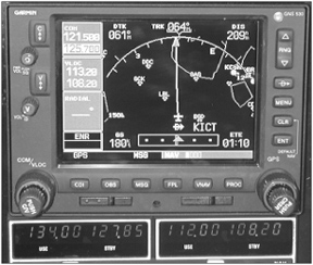
We picked the closest IAF, reset the Garmin 530 for another try and flew direct. Five miles before arriving the IAF-this time, ELIJE-we got another approach clearance again with no heading, no fix name and no crossing restriction, although radar contact was affirmed.
Fortunately, Florida is pan flat and, by now, we were above the undercast in bright sunshine with no worries of hitting terrain. The consequences of this freelance style of approach clearance could be less benign in hill country in serious weather. If such were the case, could we count on the controller to be less blas about the clearance and missed approach instruction? Were not so sure; you shouldnt be either.
We did talk to Tampa Bay TRACON and we learned that since our April flight into ZPH, the fixes have been depicted on the facilitys video map, which we count as progress. Further, the MVA in the area is 1600 feet, thus vectoring can happen at unusually low altitudes. We were told controllers have been trained in issuing GPS approach clearances but also conceded that some of the nuances arent grasped by everyone sitting in front of a radar display. For what its worth, weve seen confusion over GPS approach clearance terminology when working other facilities, namely Philadelphia and New York, under circumstances similar to our Florida flight.
Vectors Or Not?
A constant point of confusion for pilots flying approaches in radar fringe areas is whether vectors to final will or wont be offered. The controllers manual advises controllers to inform the pilot what to expect, using such phraseology as expect radar vectors to the final approach course or vectors to the GPS 36 and so forth. But sometimes, the phrase is dropped intentionally or inadvertently and vectors are still given. On the other hand, if radar vectors are expected but not provided in what appears to be a radar environment-as was the case with our Zephyrhills example-you have to set up the GPS accordingly and fly the full approach. That may include the requirement for a procedure turn, about which ATC will likely be clueless. If there is confusion about this, the best way to handle it is simply to ask: Will this be vectors or the full approach?
Second, make sure you are either assigned a specified crossing restriction for the initial approach fix where youll be entering the approach or you otherwise know what that altitude is. If theres a published TAA for the approach and youre in a radar environment, the controller should issue position information: Youre three miles from ICZOR, cleared for the GPS 36 approach. However, the controllers manual doesnt require an altitude restriction; the assumption is that its given on the TAA segment of the plate.
If theres no TAA and ATC offers a crossing restriction at something lower than the minimum safe altitude on the plate, ask if youre above the local minimum vectoring altitude (MVA). If yes, carry on. If youre not in radar contact and the controller says as much, dont descend below the MSA unless youre safely established on a solid black line, such as a published transition or a leg of the approach. Remember, crossing restrictions usually state cross at or above. The more air between you and terrain, the better.
The post-missed-approach phase offers another chance to prang terrain or obstacles if ATC is winging the clearance. In the example given here, we were issued what appeared to be a non-radar-based clearance to fly direct to an IAF. No IAF was specified and the clearance didnt require us to climb to a specified altitude before proceeding to the fix of our choice. No vector was offered, either.
Was ATC guaranteeing that we would encounter no 800-foot TV towers en route from the missed approach course to an IAF of our choosing? Not quite. Whether we liked it or not, we were on our own for terrain and obstacle clearance, since no vectors were being provided. The right way to do this is to stay on the published missed approach until in radar contact and above ATCs minimum vectoring altitude or, if non-radar, remain on the black lines until at a published altitude.
Practicalities
In Florida, where towers represent the most serious hazard to low-altitude IFR flight, this sort of loosey-goosey bending of the approach and missed approach clearance rules doesnt represent much risk. Its just sloppy and, ultimately, confusing for pilots who may or may not be expecting vectors. Some of the guys behind the scope simply arent keeping up with the profusion of GPS procedures and fixes.
In hilly or mountainous areas, the risks arent nearly so benign. Its quite conceivable that a missed approach course could be routed through a valley with minimum terrain clearance. Abandoning the miss for direct to an IAF or another fix at the wrong altitude could drive you directly into the dirt. In our view, as more GPS approaches appear in non-radar areas, the higher the risk.
What to do? Two things: take control of your approach clearances and have broad awareness of terrain and obstacles, using a sectional, GPS or both. In flat country, the risk may be too trivial to worry about, although uncharted towers are always a worry. In mountainous terrain, be cautious of approach courses that thread the needle through terrain; stay on the black lines when you find yourself flying one and avoid shortcuts direct to fixes, even if ATC approves or is simply silent.
When a GPS or RNAV approach is offered, know whether vectors will be provided or if youre expected to fly the full approach. If the latter, inform the controller what IAF youd like to use and make sure theres enough air under you to get there without hitting anything. It never hurts to ask if youre above the local minimum vectoring altitude or minimum instrument altitude. When you are, terrific. When you arent, know whats under you by reference to a charted TAA segment, an MSA circle or a sectional. If the numbers dont add up, find out why. Better a few dumb questions than a tree branch through the windshield.
Also With This Article
“GPS Approach Clearances”
“What The AIM Says”
“GPS Approach Tips And Tricks”
-Paul Bertorelli holds ATP and CFII certificates and is editor of Aviation Consumer magazine.


