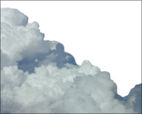
Nothing can spoil a nice trip on a good-weather day like bumpy air. Like most other things in meteorology, its somewhat possible to predict turbulence. But unlike most other things in meteorology, as well as in life itself, there is something you can do about it. Altitude, time of day, tall-and not-so-tall-buildings and the relative flatness of the terrain over which were flying can all combine to make what should have been a smooth, relaxing flight into your (or your passengers) worst nightmare. Sometimes, those are the cards youre dealt. Most of the time, though, it doesnt 288 have to be that way. Fluid Dynamics The air that supports our aircraft is a fluid subject to the laws of physics. Ignoring the local influence of the sun and obstructions for a moment, when the wind blows, its flow is laminar-all air moves together smoothly. Even though that air might be moving rapidly it will be pretty smooth. If you upset the laminar flow of that wind, things can get interesting in a hurry. The upset can be something physical like a mountain or just a different air flow. The result on the nice days is just a slight change to the laminar flow of the wind. On bumpy days, though, the result is air in the boundary between the laminar flow and the upsetting influence is not smooth at all. In fact, there are often eddies and backflows, same as you get aft of an airfoil thats just at or past the its critical angle of attack. Depending on the strength of the wind and the opposing forces, those eddies and backflows can be slight or quite severe, with the corresponding flight through them being either a little jittery or enough to separate wing from fuselage. Blame It On The Sun As we know, the sun is responsible for just about all the weather here on planet Earth. The sun heats the air and the surface of the Earth unevenly. With the hotter air rising and the cooler air sinking, and the air trying to flow from the resulting higher pressure areas to the lower pressure areas, patterns of wind develop. Add moisture, the Earths rotation and the friction between the surface and the atmosphere, and you end up with a complex system of temperature, moisture and air flow that only a physicist with a supercomputer can appreciate. Fortunately for mere pilots, we can make things a lot simpler. While there are an infinite number of things potentially disrupting the laminar flow of air and causing turbulence, we can simplify them to a few common causes and learn what to look for. Since were already talking about the sun, lets consider convective activity. The ground heats up in the middle of the day and the hotter air starts rising. But, as weve learned, that heating of the ground and rising air isnt uniform. Thus, air tends to rise at different rates and volumes at different places. A boundary layer exists between each difference in air movement, and that boundary layer is most likely going to be bumpy. On a nice summer afternoon, you can easily recognize this phenomenon by the pretty little cumulus clouds dotting the sky. These are usually separate little clouds that are otherwise harmless, but theyre a dead giveaway there is bumpy convective activity from the ground up into those clouds. Cumulous clouds of this type often will form at between about 5000 feet agl up to around 13,000 feet agl. There are only two things you can do about this type of otherwise good-weather convective turbulence. You can either leave the area, which might involve a detour of hundreds of miles, or you can climb above the clouds. Given the typical cloud tops, climbing above might require oxygen and even a turbocharger. Of course, as with most turbulence caused directly by convective activity, you can usually avoid it by flying only late at night through mid-morning. As the day wears on, this convective activity and the resulting benign clouds can gather and intensify. In the extreme, they can unite and become the kind of late-afternoon thunderstorms legendary in the desert southwest of the U.S. Thunderstorms A thorough discussion of thunderstorms would require many magazines, not just these few pages. So, let us just state the obvious: Flying through or near thunderstorms can be bad juju, leading to dramatically shortened life expectancies or harshly increased insurance premiums. If the cells are isolated, you can go around them. Most popular advice suggests that its best to pass upwind from the cell by at least 5-10 miles. If you must pass downwind, give the beast at least 20 miles. If the cells arent isolated or form a line, its seldom practical to try to top them. But if you can, dont even consider it unless you can clear it by about 50 percent of its developed height or by at least 5000 feet, whichever is less. Still, be prepared for some big bumps. The concerns about flying over or downwind of thunderstorms surround the possibility of sudden cell growth and hail being ejected. We know of one new Citation owner who passed about 10 miles downwind from a big mature cell over the Rockies and ended up with about $90,000 of hail damage. Their deductible was $100,000. We dont often think of going under a thunderstorm, but that is often practical. If the storm is developing, its going to be bumpy, perhaps severely so, closing that option. Check Pireps and surface reports. But if the storm is dissipating, there are generally just descending currents and sometimes heavy rain to contend with. If you can maintain a healthy terrain clearance and deal with the rain, this is often the best option other than a 180. Obstructions The “new” Denver International Airport (DIA to the locals, DEN to the FAA) is a wonderfully designed airport in one of the worst possible places. Imagine a smooth but swift-running stream. Its peaceful and serene. Now, imagine a rock in the middle of the stream big enough to just break the surface of the water. Notice how there is a bit of a void immediately downstream and then rather rough water a bit further down as the water rushes in to fill the void? If the water is fast enough or the rock big enough, there might even be back-currents. Thats what you can see; its worse below the surface. Well, the airport fathers picked just about the exact place “downstream” from the prevailing wind over the Rockies where the air is the roughest and decided to put their new facility right there. Whenever there is any western wind at all, theres going to be at least a bumpy ride down final, if not low-level wind shear alerts. On an otherwise very nice day with moderate temperatures and even relatively moderate winds, its common for there to be a loss or gain of 10-20 knots of airspeed on final to Denver. If youre heavy or close to the ground, pray its a gain. Add even gentle convective activity-which is also common-and things get worse. Most anytime there is a physical obstruction to the wind flow, there is a high possibility of turbulent air downstream simply because the laminar flow of the wind is disrupted by the obstruction. Its easy to predict this simply by noting the wind and terrain (or even man-made obstructions if youre close to the ground). If you can fly high enough, of course, you can generally get a smooth ride above all this turbulence. If not, other than avoiding the area altogether, theres not much else you can do. This same phenomenon happens more dramatically on a smaller scale with wind just past a mountain ridge. Pilots schooled in mountain flying know to avoid the lee of these windy ridges for fear of encountering significant downward currents or turbulence as the air passing over the peak attempts to follow the terrain on the other side, and possibly fails to maintain its smooth flow. Man-made obstructions often cause havoc on short final and into the flare. Its good to note the wind direction and speed and any buildings or uneven terrain within at least a few hundred yards upwind of the touchdown zone. If conditions are right, it can mean the difference between a nice touchdown and an “I-cant-believe-we-made-it” landing. To avoid this, first be ready for it. If possible, land short or long to avoid the worst, or pick a different runway. Mountain Wave No, were not talking about you waving at the camera from the top of Pikes Peak for the picture youre going to send to Grandma. As you probably recall, stable air has found the altitude where the temperature and the pressure of the air mass “belongs.” If that stable air is forced up or down, it will try to return to the altitude it likes. Frequently, when that stable air is moving (its windy) and encounters an obstruction like a mountain, the air mass is forced up-slope, or higher as the air flows over the mountain. If the relationship between the wind speed and direction, and the gradient of the terrain are such that the airflow can remain reasonably smooth or laminar, there will be little or no turbulence. However, that entire air mass has been displaced from its ideal altitude and it wants to return, so when it can, it will start to deflect lower. But since the air has mass and energy through its horizontal movement and now its vertical movement, it will overshoot the ideal altitude and go too low. Then the process reverses and the air starts to rise back up as it continues its path over the ground. This smooth oscillation is called a mountain wave and can result in a moderately annoying climb or descent up to a rather significant altitude displacement over time of up to plus or minus a couple thousand feet per minute. If moisture and temperatures are right, lenticular clouds can form, but its more common to simply find small, stratus clouds evenly spaced downwind from the mountain. Just as often, though, moisture and/or temperatures arent right and no clouds are formed. Mountain waves can continue for up to a couple hundred miles downwind from the original disturbance and can obviously be severe enough to make it nearly impossible to maintain altitude. The textbooks tell us that we can exit the mountain wave by climbing more than 50 percent above the height of the mountain that caused it, but practical experience suggests that often much more is required, probably due to the mountain wave being strong enough to influence the adjacent air masses. In theory it can also be possible to descend below the wave, but we suggest caution with this. Terrain may prevent you from descending far enough and we dont like the idea of being stuck in a -1500 fpm current when getting close to the terrain. The best way to deal with the waves is to either ride them out if possible and with ATCs cooperation on altitude, or to turn 90 degrees and try to fly out of the area. Even that perpendicular course may require quite a distance if the wave is widespread as in east of the Rockies. Fly It The best defense against turbulence is situational awareness. Know the general wind patterns, the likelihood of convective action and the location and types of obstructions such as mountains. Plan accordingly to climb above the convection if possible and remain clear of the areas of obstruction-caused turbulence, or simply fly in the early hours to avoid nearly all of it. With a little planning, that perfect day to go flying might also yield smooth air. Frank Bowlin is a regular contributor to Aviation Safety, Aviation Consumer and IFR magazines.