
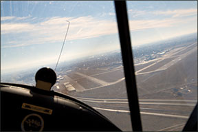
You are on approach in busy airspace with an even busier cockpit…you are changing frequencies, receiving vectors, looking for traffic. You are well into the descent phase. As you flip through your kneeboard to get ready for the final phases of flight, you instinctively start looking for the runway. You see one in front of you just as ATC asks, “Do you have the airport in site?”
288
“Affirmative,” you respond with confidence.
“Cleared for the visual approach, contact tower on 118.5,” ATC routinely responds.
There’s just one problem. Your destination airport is 10 miles further. Oops. The runway in front of you isn’t the one on your flight plan, nor is it the one you were just cleared to. The mistake seems unforgivable, but it happens, and not just to 747 Dreamlifter crews, though those are the stories we read about. It may even have happened to you.
Or maybe you’ve come close, but you caught the mistake when you realized your navaids weren’t cross-checking, or the controller saw you descending too early, or you saw something to alert you that you were still 10 miles out. Pilots and controllers often get a gut feeling something is not right somewhere during the sequence of approach events. Of course, if you’re really unlucky, you continue despite your gut feeling and land at a military base where you’re met by armed guards.
If Wishes Were Fishes
Pilots misidentify airports due to an array of cognitive biases. We’re especially vulnerable when we are in a descend-to-land frame of mind. When we get the answers we want and expect, we tend to stop being skeptical and stop questioning. And that’s when misidentifying our destination airport becomes a mistake.
Here’s how it happens.
You know your long flight is almost over and you’re ready to be on the ground. Sure enough, an airport comes into view, just when you expected to see it. That’s expectation bias. Of course, you were already actively looking, even to the point of predicting where and when you would see it. It was right where you thought it would be. That’s confirmation bias. And given the state of your bladder and fatigue, you want it to be true, so you are happy about it. That’s wishful-thinking bias.
288
You confirm you are right: Yes, west of the Interstate highway, west of the railroad. You just executed a confirmation-bias-do loop. That’s cognitive anchoring.
Now that you’ve spotted the airport you were looking for and have mentally locked in that you think it’s the right one, you switch gears. The decision is made. There’s a lot to do before you can land—go through the checklist, prepare for landing configuration, contact the tower or make your call to CTAF. You’ve moved on even though you have reached the wrong conclusion.
ATC, Another Link in the Chain
When you establish communication with a tower, you can’t always assume they know where you are since radar services are at only about half of the U.S. airports with towers. Non-radar towers, like non-towered fields, rely on self-reporting. If your plane is the only one the tower is working, it is common for ATC to use phraseology like “not in sight” along with “cleared to land.” The tower or other aircraft in the pattern may ask you for a position report. But if you’ve misidentified the airport, your self-reporting is not going to help.
Instead, your bad underlying assumption means that everybody in the system is working with the bad data you’re feeding them. Others using the airport at which you are mistakenly arriving won’t know anything about you either, because you are on the wrong frequency. Meanwhile, it’s possible that the airport you are talking to thinks you are arriving and is moving traffic around accordingly and may actually be sending aircraft into your face. The sequence of misinformation passed back and forth can easily continue all the way to the ground…or worse, stop mid-air.
They All Look Alike
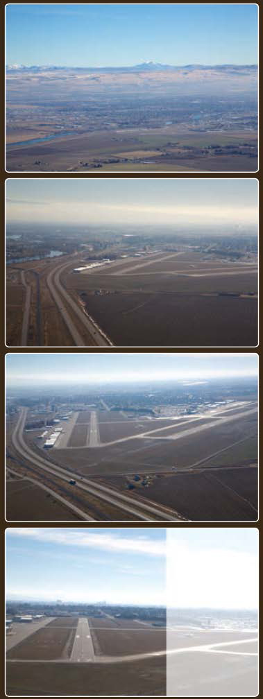
One reason pilots fall prey to the mistaken identity error is airports aren’t always easy to see from the air, and when they are visible, they often look alike. Let’s say there are 10 airports in a 20-mile radius. There is a good chance they all will have similarly oriented runways, and even if they have two runways, regional wind patterns will often cause the second runway to be similarly aligned. It’s likely even the runway numbers will be the same.
Distinguishing markers and patterns of development also conspire against positive identification. On maps, city borders and highways look distinctive, but from the air, those outlines in urban and suburban settings are much less clear. Cities throughout the U.S. often are linked by large prominent railways and highways extending along a common cardinal direction for hundreds of miles. On the outskirts of a major city, it’s common for bedroom communities to be spaced at roughly even intervals. On a long cross-country, it’s surprisingly easy to confuse Community A for Community B.
The best way to avoid confusion is to use real data rather than trusting your observations. Some 30 years ago, I did a long cross-country that passed over myriad small towns in Kansas and Nebraska. I had meticulously plotted pilotage checkpoints on my sectional and flight plan—highways, roads, railroads and power lines—but the summer haze brought in-flight visibility down to 3-4 miles. At one point, I got a little distracted and lost track of which town was next. When I checked the town ahead—sure enough—there was a race track on the north side and a railroad paralleling the highway, so I “knew” where I was.
The only problem was that the next three towns, all spaced an even distance apart, had the same exact features. They were seemingly clones, and I started to doubt my assumption. However, I was fortunate to have a VOR abeam my flight path. I confirmed my location on the map with the radial and discovered I was one city further along my route than I realized.
Gadgets as friends?
I hear old-timers grouse about pilots who stare at the GPS and never look outside the cockpit. They have a point, but I think the only thing worse than a pilot who over-relies on his in-cockpit tech is one who doesn’t rely on it at all, or does so without a purpose.
Geeks may have their head inside the cockpit a bit too much, but generally speaking, they know exactly where they are. Moving maps are amazingly reliable…unless you have lost the GPS signal and failed to notice the map isn’t moving and the airplane is stuck in the same spot.
Another point of failure—where moving maps can lead you astray—is when you aren’t paying attention to scale. If you are zoomed out, you may get the sense you are almost at your destination. But zoom in from the 100-mile scale to 20 miles and what seemed like an imminent arrival turns into still-a-ways-to-go. To avoid this, keep at least one block of numeric data in your scan. It is hard to misinterpret a specific number of miles or minutes to the destination. Verify you have GPS signal. Maps are great, hard data is better, and accurate data even better still.
A third common mistake is confusing the mileage to your next waypoint with the mileage to your destination. Look at the data in front of you, then verify you know what it is actually telling you.
Right Airport, Wrong Runway
Getting the airport wrong is mortifying. But you can be at the right airport and still commit the embarrassing mistake of lining up for and landing on the wrong runway. My home airport in Idaho Falls, Idaho (KIDA), perhaps is subject to this error more than most. For the record, tower personnel tell local pilots it has happened about once a week lately, and often several times in a single day.
In part, the confusion has to do with two south-trending runway alignments. The most common mistake is that pilots cleared for right traffic, or straight in for Runway 20, line up and land on Runway 17. Both are generally southerly trending. That is the problem; they share a common approach path when landing to the south.
Pilots who identify the airfield from a distance easily can see the prominent line of hangars marking the airport’s east side along the edge of Runway 17/35. That identifying factor helps them keep the airport in sight when they’re still a good distance out, even without needing to see the actual runway. Since the Runway 20 clearly has a south-trending alignment, there is confirmation bias: Pilots looking for a southerly runway see one and assume it’s Runway 20, the one on which they were cleared to land.
The second reason—now you’re in the confirmation-bias-do loop—is that Runway 17/35 stands out better from the background view of the city. If you’re looking for a south-trending runway, it’s likely you will fixate on the prominently visible, hangar-lined, 4000-foot runway rather than the 9000-foot concrete behemoth blending into the background a bit more readily.
The third reason—and you’re still in the confirmation-bias-do loop—confirms any prior information. You roll from base to final following the most commonly assigned right-hand traffic pattern and Runway 17/35 sweeps into view 30 degrees earlier than Runway 20. So, right while you’re making the base-to-final turn, when you’re busy adding flaps, checking airspeed, sink rate, doing a GUMPS check and preparing for the landing, you look out the window and it’s almost instinctive to roll out and line up on the runway you see. Once you see the VASI lights and runway centerline, you are all but cognitively blind to the runway 30 degrees off your right…the one you were cleared to land on by the tower.
Unfortunately, the tower can’t help you. From their perspective, it’s very difficult to tell which runway you are lined up for until you are nearly over the numbers. If they catch you early on the final descent, you may get a cancellation for your clearance to land Runway 20 and get a clearance to land on 17. This will save you a pilot deviation report, but it is a courtesy. If you are too low and not conflicting with others and flying an aircraft that can safely land on a 4000-foot runway, the controller may decide it is safer to not call out your mistake until you land. A change-up by a tower controller at the threshold or over the numbers can be less safe than allowing the violation (See KPIE for the danger of last minute corrections).
Another runway mistake at KIDA is less common. It has to do with the unfortunate reciprocals of Runway 2 and Runway 20. By dropping that last digit, the runway is aligned with 20 degrees on the compass is Runway 2, not 20. When winds are calm, it is reasonable to be assigned either one. If you don’t hear it right and fail to give a readback, you own the mistake that is coming.
This reciprocal affliction isn’t unique, it also affects airports with runways aligned 13/31, and to a lessor degree 1/19, if the last part of the transmission is stepped on or not clearly heard by the pilot.
This is the point of a pilot readback. It is not just to repeat what you are told, but to stop, mentally process the information so you understand the implications, then restate your understanding back to the controller and cross-checking the numbers before touching down. After all, that is why the numbers are prominently painted on the runway. Right? When you do your readbacks by rote, or not do them at all, it’s much easier end up on the wrong runway.
It also is somewhat common for pilots to occasionally confuse position reports with reciprocals. When an aircraft is to the west of the field and inbound, the pilot is looking at a compass pointing east, the direction of travel. When asked to report position, pilots often report their distance out and, without thinking of the implications, report their direction of travel rather than their direction from the field.
This mistake, more common with less-experienced pilots, leads to the same mistaken runway situation. Tower thinks the aircraft is coming from the east when it is actually an eastbound aircraft coming from the west. If the aircraft is assigned a right base to Runway 20, the pilot might easily enter a right base to Runway 2, which aligns with a heading of 020 on the compass. Again, right airport, wrong runway.
Wrong Frequency?
Once I came into an airport, and there was a student pilot in the pattern who was making diligent calls at each leg, including cross-wind. I sequenced myself in, making equally diligent calls.
When I landed, the instructor came over to my plane and sarcastically said, “Nice radio work.” I thanked him for the compliment and said I was trying to set a good example for his student. “By not making any calls?” he asked incredulously. That was when I realized my mistake. My radio was listening on COM 1 and transmitting on COM 2, the frequency of the last airport I was at, which was by now out of range. Needless to say, I apologized profusely. And then I added ‘Check the audio panel transmit setting’ to my checklist.
Pick Up the Professionalism
Getting the wrong airport, wrong runway or wrong frequency is not unusual. It can be the result of data overload. Or common cognitive biases. Or just sheer intellectual laziness. It happens across the spectrum, from student pilots to captains of C-17s and Dreamlifters.
The best way to avoid the wrong-thinking trap is to honor the professionalism that leads to right-thinking. Use readbacks when given runway assignments. Cross-check your heading with runway numbers. Confirm proper airport and runway information with actual data rather than succumbing to knee-jerk affirmation that the runway in front of you is the runway you are anticipating—even hoping for.
It’s said that no matter where you go, there you are. A good pilot with professional habits will always be at the right airport, on the right runway and on the right frequency. A lazy pilot who falls for his cognitive biases? Not so much.


